World
Beryl is no Hurricane Harvey but the worry is — it may be an Alicia

Friday July 5th update:
As we head into the weekend I wanted to share a few thoughts with you. If you are reading this late Saturday or even Sunday you are reading an outdated article.
Please find the new information on click2houston.com.
Beryl is no Hurricane Harvey:
The concern has been expressed that because Beryl may hit near Rockport, Texas that it would stall and create catastrophic flooding like Harvey did in 2017. While Beryl may hit near Rockport, that would be the only similarity. In 2017, two areas of high pressure, one in west Texas and the other near the Great Lakes, blocked Harvey from moving.
On Monday, the only similarity will the be the high pressure near Florida. The other upper level high is near California and a trough of low pressure is north of Texas.
This is not a blocking weather pattern. The trough and high will be able to move Beryl out of Texas. My bigger concern is the trough and the high working together to steer Beryl closer to Houston.
Hurricane Alicia in 1983 hit Southeast Texas as a category 3 storm. It created incredible wind damage similar to the derecho in Houston two months ago.
My concern is Beryl getting strong and possibly hitting Southeast Texas straight on!
Friday night Beryl track:
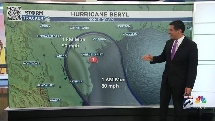
The concern Friday night is the landfall track has shift even more east. Matagorda Bay has the possibility of a direct hit from Beryl.
When you include the spaghetti tracks and and the European model you can see a bullseye on Matagorda Bay.
Current watches in SE Texas:
Hurricane force winds are possible within the next 48-hours in the orange outlined area. Life threatening winds are possible in the orange colored areas.
A storm surge watch is also in effect with a storm surge of 3-5 possible. The closer Beryl gets to us the higher this level will be.
Houston and rain:
A lot depends on Beryl’s ultimate track but as it stand right now, much of SE Texas could see around 5″ of rain fall in the next five days. Flooding is possible We’ll keep you posted.
Copyright 2024 by KPRC Click2Houston – All rights reserved.


:max_bytes(150000):strip_icc()/roundup-writereditor-loved-deals-tout-f5de51f85de145b2b1eb99cdb7b6cb84.jpg)


